Trailblazing in 2024

Since our inception, GeoPulse has mapped 2,400,000m2 of road and turf across Singapore. That’s covering an impressive area of more than 592 football fields !!

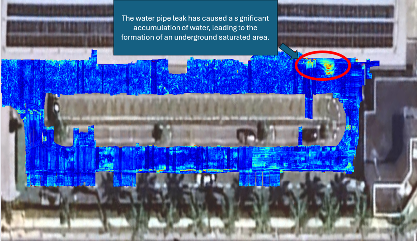
This year, GeoPulse has played a pivotal role in delivering professional services to over 70 projects, demonstrating our expertise in subsurface analysis and utility management. By "seeing the unseen," we have supported a diverse range of public and private entities, offering insights and strategies for optimal excavation and utility management. Whether it's identifying the best locations to install new services, detecting underground water leakages, voids or other anomalies, GeoPulse has consistently provided innovative and practical solutions.

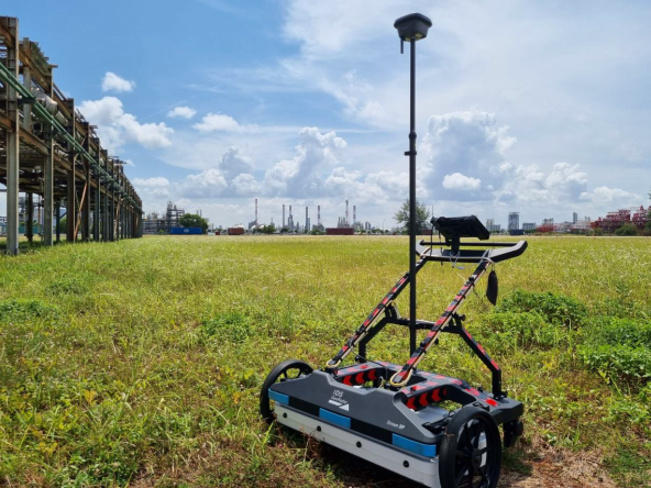
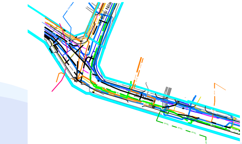
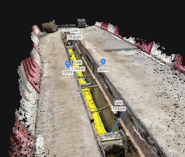
Our capabilities extend beyond our core scanning services, which leverage the advanced Multi-Channel Ground Penetrating Radar (MCGPR) technology. Complementing this, we have developed Geo-Located Combined Utility Plans (Geo-CUP) that consolidate and visualise utility data for streamlined decision-making. Additionally, our expertise in creating Geo-Located Point Clouds (GPC) allows for highly detailed three-dimensional representations of subsurface environments, enabling precise planning and execution for complex projects.


Through our commitment to innovation and excellence, GeoPulse continues to redefine what's possible in the field of utility detection and subsurface mapping.
The year 2025 promises to be another milestone of breakthroughs. Stay with us as we explore new horizons and set higher standards to improve the industry.

This year, GeoPulse has played a pivotal role in delivering professional services to over 70 projects, demonstrating our expertise in subsurface analysis and utility management. By "seeing the unseen," we have supported a diverse range of public and private entities, offering insights and strategies for optimal excavation and utility management. Whether it's identifying the best locations to install new services, detecting underground water leakages, voids or other anomalies, GeoPulse has consistently provided innovative and practical solutions.

Our capabilities extend beyond our core scanning services, which leverage the advanced Multi-Channel Ground Penetrating Radar (MCGPR) technology. Complementing this, we have developed Geo-Located Combined Utility Plans (Geo-CUP) that consolidate and visualise utility data for streamlined decision-making. Additionally, our expertise in creating Geo-Located Point Clouds (GPC) allows for highly detailed three-dimensional representations of subsurface environments, enabling precise planning and execution for complex projects.


Through our commitment to innovation and excellence, GeoPulse continues to redefine what's possible in the field of utility detection and subsurface mapping.
The year 2025 promises to be another milestone of breakthroughs. Stay with us as we explore new horizons and set higher standards to improve the industry.
Jan 01,2025
